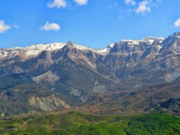


Matsouki is one of the three Vlach villages of Tzoumerka where they still speak the Vlach language like the Greek (the other two are Syrrako and Kalarrytes). It is located on the western slopes of Kakarditsa (2429 m), the highest summit of NE Tzoumerka, and is surrounded by other high peaks such as Katarrachia (2280m) and Kritaria (2200m). Those peaks form steep slopes and ravines where the streams from the waters that descend from the mountains are running.
About the village
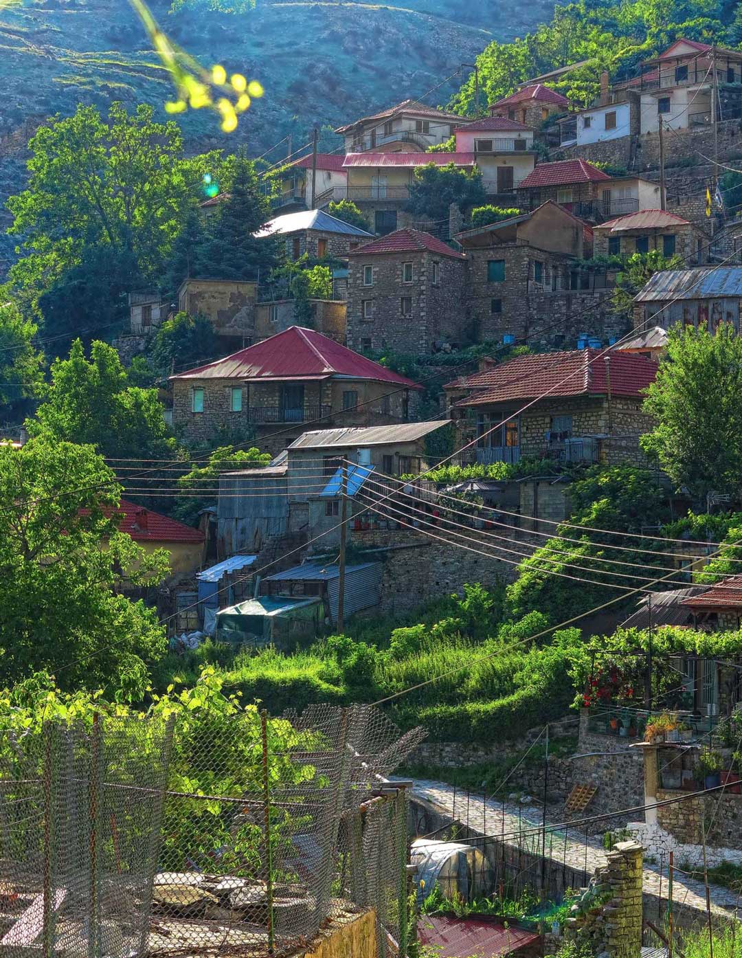
Matsouki at 1100 meters altitude belongs administratively in Ioannina and is 85 km away from the city. Access to Matsouki from the village of Christoi takes place in a breathtaking scenery.
Arriving in the village you will pass the wild ravine crossing the long 51m long Bailey bridge. Until some years ago the bridging of the gorge with a width of 48m and a depth of 44m was impossible, resulting in the isolation and desolation of the village. In the winter of 1981, the army placed a Bailey-type pedestrian bridge. Then, in August 1985 the road was opened to the village and the bridge was installed. Also, a few tens of meters away there is a second one built from cement.

It is unknown when the original settlement was created. The local tradition says that the name of Matsouki village is due to its inhabitants who killed a terrible dragon with a wood or according to another version faced and hit the enemy with stakes. Researcher Dimitris Kalousios comments that the stories with the stakes reveal the “roughness of the inhabitants”.

The occupations
According to Mr. Agelos Sinanis, Matsouki has long been known for the tailors and the famous capes they made there. Also their main occupation was agriculture and signs of cultivated land show to date with the formation of steep slopes of the soil, the terraces (protective walls) that retained the soil.
Today, unlike the other two villages of Syrrako – Kalarrytes that have been deserted, Matsouki has several permanent residents who are engaged in livestock farming. In summer, about 12,000 sheep and goats and 800 cattle are grazing in the surrounding mountains.

The architecture
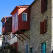
Traditional architecture is not the same as in the other two villages of Syrrako-Kalarrytes and the tingling roofs of the houses (a solution which was also contributed by the free distribution of the zinc by the state after the WW2 as financial support to the villages that had suffered destruction by the occupying forces), don’t look nice to the guests.
There are of course some stone-built houses, the very beautiful school, the maintained watermill and the traditional cafes. But surely the incredible beauty due to the amazing geographical position compensates for this disharmony, and the hospitality and good mood of the residents comes as a seal. Besides, Matsouki was one of the last mountain villages that was electrified very recently (April 1984).
What to see in Matsouki
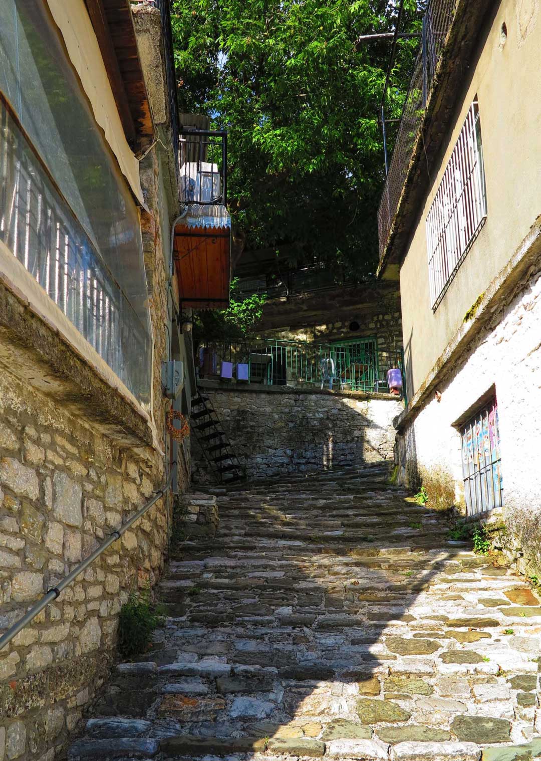
In the village you can see the old cobbled streets (stone-paved streets with raw stone), the work of the Pramantiotes. The beautiful square with spectacular views, and the recently preserved water mill with the dristella (water-jet), which has been designated as a historic listed monument (1992) and is very beautiful.

Next to the old historical school where the very interesting collection of the monastery of Vylissa is hosted, the church of Agia Paraskevi is built, a new, three-aisled basilica with a nice wood-carved iconostasis.

There are also five chapels around the area with the most impressive the one of St. Athanassios hung on the edge of the cliff.


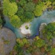
Undoubtedly, the waterfall of Matsouki is one of the most impressive sights of the village. Inside the slopes and ravines formed by Katarrachia (2280m) and the Cretaceous (2200m.), there are streams descending from the mountains.

Two of them, Mavrias and Goura, cross the village and are joined a bit below by the Red River and are then poured into the Matsoukiotiko Rema (or ravine of Stafyla). Matsoukiotiko Rema descends from Kakarditsa, crosses its homonymous gorge and a bit further below it receives the waters of Karlibou and is then poured into the Kalarrytikos River at the point where the Melissirotiko Rema is poured.
Also, near Matsouki you can visit the Vyliza Monastery.
The village is offered for wonderful walks, either with 4X4 or hiking. Through marked paths one can reach Kakarditsa (2429m) by passing the plateau of Helimodi or climbing to the top of Katarahia (2280m).
Other routes: Matsouki – Vyliza – Kallarytes (marked with duration of 2 hours) and Matsouki – Strogoula Peak (2429m without marking, duration 4 hours)