

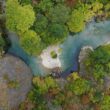


Pramanta is located on the southeast of Epirus and west of the Arachthos river, in a mountainous region with an intense geographical relief characterized by impressive ridges, extensive spruce forests, rivers, ravines and slopes, located Pramanta, a big village of Ioannina Prefecture and seat of the Municipality of Northern Tzoumerka.
It is built amphitheatrically at an altitude of approximately 840m. at the foot of Strongoula (2.107m), one of the most spectacular peaks of the Tzoumerka Mountains or the Athamanian Mountains. (Besides, the story of Tzoumerka starts with the king Athamas, from which his name “Athamanian Mountains The village Pramanta belongs to the cultural unity of the Tzoumerkohoria (villages of Tzoumerka), but at the same time together with other villages (Christoι, Ambelochori, Ktistades, Raptanei) belongs to the unity of Mastorochoria of Tzoumerka.

Historical information for Pramanta
The place name Pramanta appears for the first time in a document of the Venetian Republic in 1697. According to historical records, three are the main versions of the designation of origin.
The linguists Charalambos Symeonidis and Max Vasmer argue that the origin of the word Pramanta is Slavic. The historian Panagiotis Aravantinos reports that the area was called Prοmanta because it served as an oracle of Dodoni and 3) according to the oral tradition, the name derives from the word pramata, terminology with which it refers to goats and sheep According to Dimitrios Karazenis (“HISTORY-LAOGRAPHY», Pramanta Tzoumerka”), the animals of Christi and the other settlements grazed in the area of today’s “Kato Mahalas” mainly during the summer months.
Animals in the local dialect are called pramata. Thus, the village was originally called Pramata and after a decision of the Town Hall was added, for euphony, the n and became Pramanta.
It is unknown when the original settlement was founded. Some finds (traces of ancient settlement, a stonecutter, fortified ruins, cyclopean walls, etc.), found in the area of the Panagia, Aghios Vassilios and Christoi settlements date back to the Neolithic Age.
More specifically, in 1930, historian Nicholas Hammond, one of the most important English Hellenists, found a stone rectangle ax near the church of the Virgin Mary in Pramanta and in Christ, in the area of Pramanta, an ambitious bronze ax, which was an effective weapon and spread to mainland Greece from the Aegean Sea.
However, without a more systematic research, we cannot say with confidence that the area has been inhabited since then. But we certainly know that the whole area with the surrounding villages had been inhabited since ancient times, and somewhere in the middle of the 15th century it also showed great growth.
In Pramanta there was a school operating since 1864. In 1873 there were 2000 residents and two Greek schools operated with 210 students, supported by subscriptions. Eight years later in 1881 and three years after the Treaty of Berlin (July 1878), the village, as well as a wider part of Epirus, was liberated and annexed to the Greek state.
The Province of Tzoumerka was established, consisting of the municipalities of Theodoriana, Agnanta, Pramanta and Kalarrytes, with Pramanta be the capital of Province. Within a short time the village was organized with the establishment of the Postal Office and the County Court in Pramanta and a Customs Guard and Sanitary Station to Christi. In the same year on August 20th in the parliamentary elections that took place, Tzoumerka claimed 2 seats.
In 1883, the Municipality of Pramanta was established and operated until 1912. In 1912 he was detached from the municipality of Pramanta and became the seat of his own homonymous community, which passed (1925) from the Province of Arta and Tzoumerka of Arta’s Prefecture in the province of Ioannina in the Prefecture of Ioannina.
But, despite the fact that the borders were set on the Arachthos River, the village was not completely free since it was feud of Abraham Pasha,who in 1888 sold it to the big landowner Karapanos for 3500 gold pounds, who had also bought other villages of Tzoumerka.
The formion of the large tsifliks in Arta and Thessaly had begun between 1878 till 1881 the year that the Treaty of Berlin was signed and Arta and Thessaly were annexed to the Greek State.
The absolute liberty was acquired when the inhabitants bought it (9/8/1889) from Karapanos for 4200 gold pounds. In 1897 Pramanta became a military center, where the habitants helped the other Epirus villages beyond the Arachthos river, which were still under the Turkish yoke, since freedom for them came in 1913 with the liberation of Ioannina.
The area of Tzoumerka experienced the great reorganizations caused by World War I and the National Divide. In the wars that followed (World War II, Civil War) many residents lost their lives, while many were forced to flee their homeland, especially when the village was burned by German troops.
On the morning of May 1, 1967, the second day of Easter, a strong earthquake measuring 6.4 on the Richter scale caused extensive damage. Pramanta was among the villages of Tzoumerka where the greatest intensity was observed.
In 1997 Pramanta became the seat of the then newly established Municipality of Pramanta, while in 2010 with the program “Kallikratis” it became the seat of the Municipality of North Tzoumerka.
Since the period of antiquity in the Tzoumerka region, livestock farming, forestry and the limited cultivation of land due to small arable land were the main productive activity Livestock breeders have created the tseligata (a type of informal cooperative associations) which have prevailed almost until our days, but not with the same dynamics of the past.
Tseligata was created by the need to share large-scale pastures, due to the absence of security at that time and the lack of credit institutions for the financial assistance of individual breeders. The breeders joined their flocks under the leadership of the economically stronger, tseligas, which had the most animals and who could more easily rent meadows for the wintering of communities and individuals Tseliga’s area of influence was not limited to the sphere production but extended to the entire social life of the collaborators breeders and their families.
Agogiates
One of the main and old professions of the Pramantians was that of the carrier (agogiates= transporters of people and goods over long distances).
These people are also mentioned by Dimitrios Karatzenis, historian and folklorist from Pramanta: ”For years these people have been doing this work constantly, irrespective of the weather. Life in the countryside was difficult at the time before the 1940s, when the mountainous villages without roads were excluded due to bad weather. The Pramantian carriers (agogiates) madetransfers from the towns to the village and vice versa. In addition to transporting food and other things they also transported families to the summer holiday destination. Until the 1940s war, the number of mules that made up the caravan was 900. Of the mules, a small number belonged to the livestock farmers who were occasionally engaged in transport. Every Tuesday they left the village, on Wednesday they arrived in Arta, on Thursday they were shopping and on Friday morning, independently of weather conditions, they took the road back to reach the village on Saturday night and Sunday morning to sell their merchandise in the courtyard of the church. On Monday they were resting and on Tuesday they started the route again. The agogiates had also their own shops supplying them with products sold by women and their children the other days of the week the other days of the week that were missing. And of course there were also trains that kept them much longer away from their fires in much more distant places than Arta and with paths in the mountains of Pindos. And grooming of mules was another tiring job. The mules were sturdy and could carry up to 130 okes (turkish unit of weight) (167 kilos). And the purchase price of a mule pre-war reached 19,000 drachmas equal to half the price of a car”.
The same work was done by the neighbors of Melissourgoi. Exhaustive work and most of them died at the age of 50-60 years. This profession was lost with the appearance of cars and the endless suffering of these people ended and only the stories are witnesses of a harsh era.
Tailors
Another profession occupied by the inhabitants was that of the tailor. This activity was complementary and seasonal and, as a rule, moved to different areas away from their village carrying the equipment of their work. Like the other categories of professionals, the tailors also had their own dialectic language, the “boukoureika”. According to the headmaster, author and folklorist Christos Soulis (1892-1951), the home of “boukoureika” is the village Katarraktis. From Katarraktis, the dialect was transmitted to the tailors of Agrafa, Epirus and the areas of Valtos and Xiromero in Aitoloakarnania. This language was used to prevent their customers from understanding them.
Northern Tzoumerka can hardly be identified from a musicological point of view. Apart from the local companies that were created in the Vlach villages of Syrrako and Kalarrytes, the rest of the area was supplied mainly with companies from Ioannina. Characteristic of the local peculiarity is mainly the repertoire, which, even in its Vlach version, insists on “heavy” and “in the place”, tsamika, with many references to the kleftiko song. The dances are skillful and expressive. The main companies are those of the Gerodima and Diamantis families from Pramanta.
The oral memory in Tzoumerka is associated with historical events that were recorded as symbols of resistance and freedom and are preserved in the memory of people even those who have left their place. In the area of Tzoumerka we meet the custom of the dance “Kangelari” which is an imposing circular dance. It is done once a year and everyone participates. It got its name from the clockwise and counterclockwise shootings that the dancers go around in “Circles” and the name “Kangelari” is later.
Written and oral testimonies state that the “Kangelari” was created during the Turkish occupation, but there is also the view that it is related to Ancient Greece and the feasts of Demeter and Persephone.
The “Kangelari” is not a specific dance, but a ritual act with a deeper meaning that is hidden under its simple form. The inhabitants dance in circles with their elbows, which indicates the unity and continuity of the community, and the rhythm of the song and the steps are slow and monotonous, characteristic of the initiation ceremonies.
The universal participation and the back-to-back arrangement of the dancers was an excellent opportunity for the young people to get acquainted. This provision also helped in the greater communication of the inhabitants, especially during the years of Ottoman rule. The meaning of the songs had a completely different interpretation for the “initiates” An important place in the “Circles” had the saints whose people wanted protectors in every phase of life as well as the foreigners who were welcomed, a sample of the Tzoumerka hospitality. Cultural associations for years make efforts to survive this event with its various musical, poetic and dance variants.
Kostas Bekas, the master builder of the bridge of Plaka, was born in Pramanta in 1825. He learned the art of stone from a young age and undertook, sometimes with his own team and sometimes with his fellow villager Giannis V. Tsikos, the execution of large and important works, mainly churches, mansions and bridges. According to the memoirs of his son Nikos Bekas built churches (in the villages of Pramanta, Theodoriana, Vetsista) and bridges (Plakas Arachthos in 1865, Kalentinis, Sarandaporou, Sarakina Piniou, etc.). He was also a public works contractor.
The Georgakis family also comes from Pramanta, which produced many real artists, stonemasons and wood carvers. Best of all is considered Vassilis Georgakis (1853-1935) who even today remains a legend for the region of Tzoumerka. He was an excellent stonemason, but he was equally successful in wood carving, trade, distillery, mills, engraving, etc. He traveled to many places and some of his works are: the churches in nearby Matsouki and Kournes in Thessaly, the iconostasis of Stanos and Loutro in Etoloakarnania etc.His real masterpieces are considered the bell tower in Agios Bissarion of Philippiada and the so-called Fountain of the Arapis in Pramanta.
Another popular craftsman of Tzoumerka is Fotis Karatzenis from Pramanta. He was born in 1869 and grew up in a family of stone masons. He participated from an early age, learning in his father’s company. After the liberation, he decided to join a construction site where he proved his technique. He became a contractor and he was evaluated positively every now and then. He was eventually rewarded with successive promotions, which meant undertaking projects of greater value. He died in 1943, a few years after retiring from active duty.
The teacher Costas Tsirkas (1906-1944) also comes from Pramanta. In 1930 he moved to Thessaloniki where he organized in the KKE (Communist Party of Greece). In 1938 he was arrested and taken to the communist concentration camp of Acronafplia. In May 1941, after the occupation of the country by the Germans, the prisoners of Acronafplia by order of the Deputy Minister of Public Security Konstantinos Maniadakis, they were handed over to the occupiers. Costas Tsirkas was executed on May 1, 1944, along with 200 communists at the Kaisariani Shooting Range, in retaliation for the murder of a German general and his entourage by ELAS guerrillas near Molai in the Peloponnese. Without having committed any crime against the occupiers, as they were exiled or imprisoned throughout the Occupation, they were led to the executive branch solely because of their political beliefs.


Pramanta today
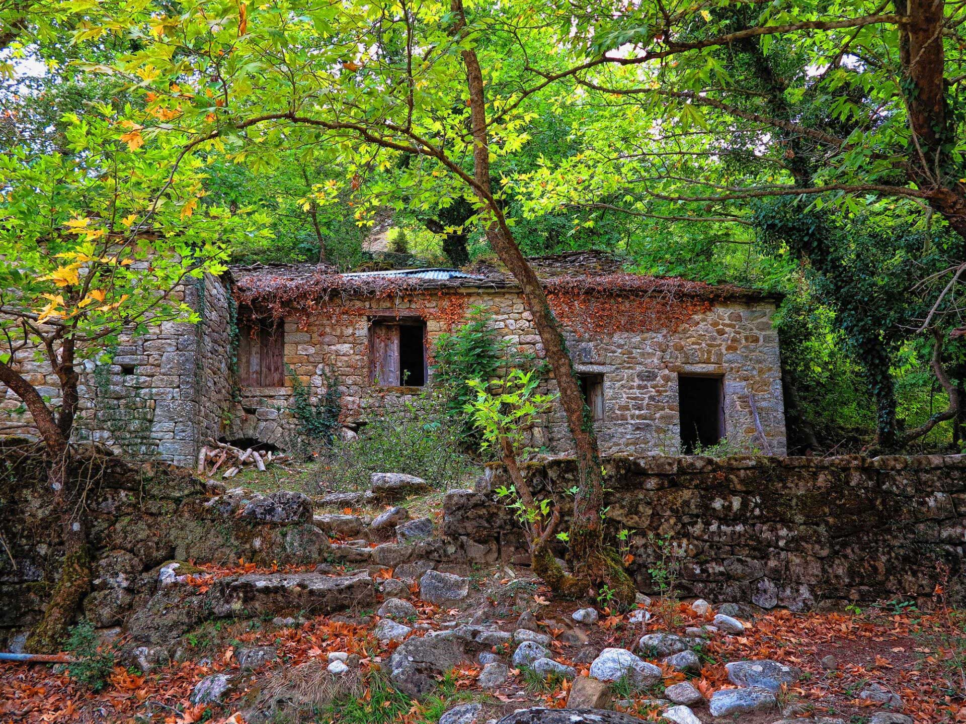
Unfortunately today there are no traditional buildings in the village, except for a few. The burning of the village by the Germans and the earthquake of 1967 destroyed many of the traditional houses. Old houses that are examples of local architecture are the houses of Vourlokas, Giannikostas, Stamos, Karakostas, Tsirkas, Tsikos.

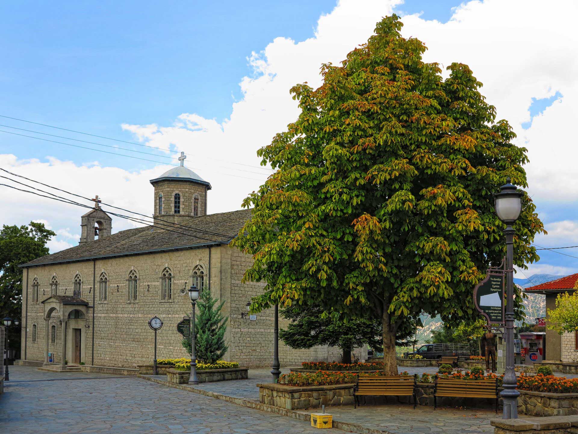
In the center of Pramanta is the beautiful cobbled square with the huge old plane tree, which was and is a reference point for the festive events of the religious festivals and the meetings of the expatriate residents during the summer days that are gathered in their birthplace.
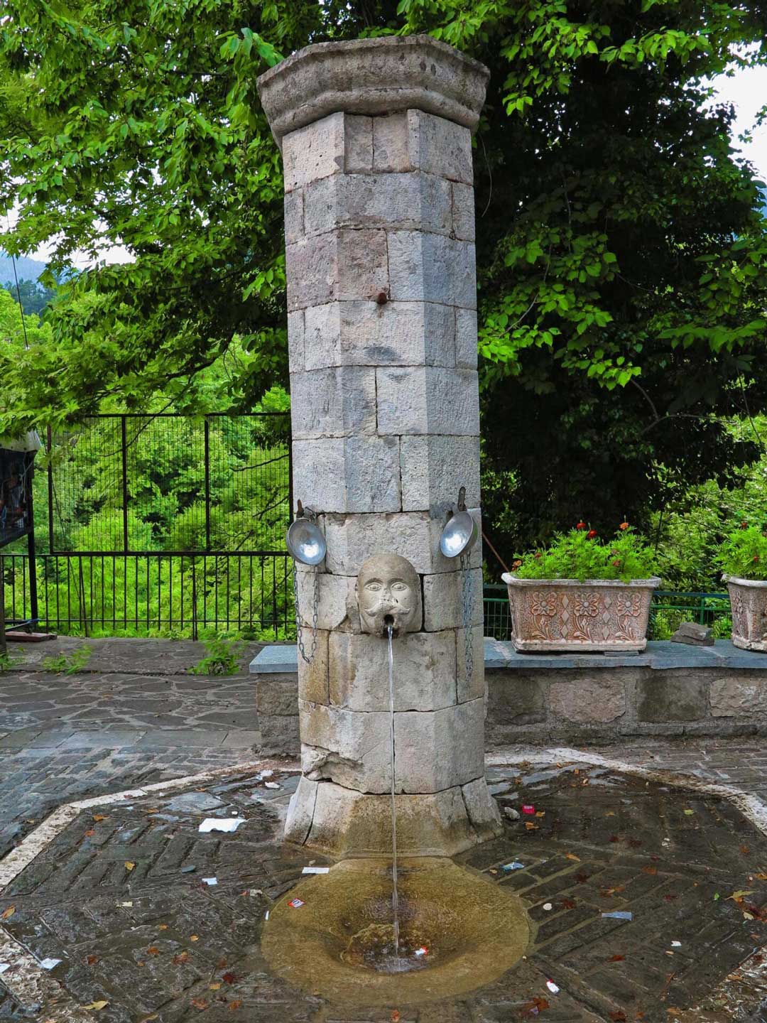

The square is dominated by the central church of Agia Paraskevi which has been designated as a historical monument and the Fountain of Arapis which represents a human head with a tap coming out of its mouth. It is the work of Pramantian master builder Vassilios Chr. Georgakis and was created in 1887. The name, it is said, comes from a black man (arapis) who stood here and collected the taxes of servitude.
The Monument of the Woman of Pramanta is a culpture in the center of the village reminiscent the contribution of the women to the nation’s struggles.
Watermill – whirlpool – mantania: Historic listed building owned by the Tsaktsiras brothers. It is a ground floor stone building of simple folk architecture with a rectangular plan. Built in 1935 is perhaps the only case of co-housing water mill, whirlpool and mantania.
The area of Tzoumerka in recent years has made huge leaps in the promotion of tourism, with the participation and involvement of professionals and with the support of institutions.
Today Pramanta is a lively village in the center of the area and the seat of the Municipality of North Tzoumerka with a population of about 800 inhabitants, which in summer exceeds 1500. It has taverns, patisseries, cafes and nightlife. It also has a modern Health Center, pharmacy, environmental education center, gas station, bank, ATM, post office, police station and schools of all levels. In this traditional village, which combines the modern way of life, the visitor can find information about everything he needs.

Tourism development in recent years is at a high level with the creation of hotels and hostels in the area. The quality infrastructure of the accommodation and the local gastronomy are key elements of a comfortable stay
The experiences gained by the visitor are quality experiences related to the experiential approach of the impressive nature of Tzoumerka and the monuments of the cultural heritage. “Active” tourism enriches the travel experience, and leads the visitor to more and more specialized activities.
The range of activities in such a natural environment is large and the options depend on the time available, the endurance and the mood. Mountains, and peaks for mountaineering enthusiasts, hiking trails, visit to waterfalls,rafting in Arachthos and Kalarrytikos, gorge descent for the adventurous, car trips to the surrounding traditional villages, visits to monasteries, churches and bridges. A special destination beyond the summer months.

What to see
Monasteries and churches
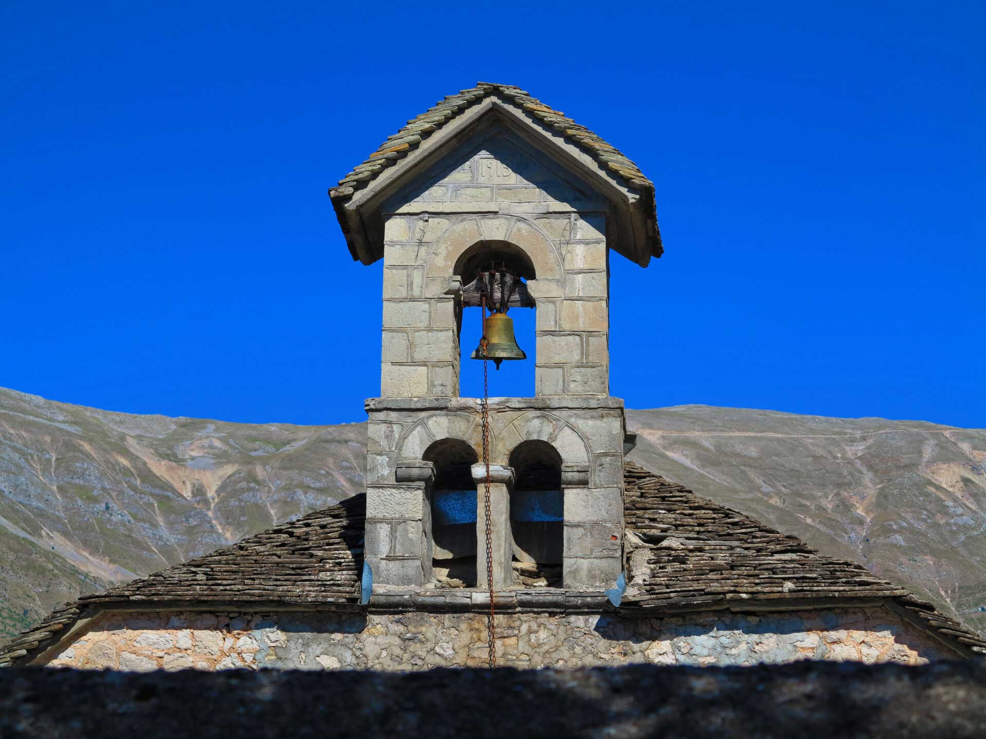
Throughout the Ottoman rule, the strong religious sentiment of the inhabitants of Tzoumerka and their deep faith helped them to face the difficulties not only of those who came from the barren land but also of those of Turkish rule. The expression of their faith is reflected in the construction of numerous churches and monasteries in the mountains of Tzoumerka.
Besides, their geographical location helped in the relative autonomy granted by the Turks and contributed to the reconstruction of ecclesiastical monuments. Most of the monasteries, apart from religious institutions, were centers of Hellenism that preserved and spread the language, the customs, the traditions, and mainly transmitted the idea of revolution and liberation to the hearts of the slaves. The successive fires of the villages have destroyed many of these Byzantine monuments and those that exist date from the 17th century onwards.
In this place from the old days there has been a small chapel dedicated to Agia Paraskevi. In 1890 the new church was founded in a basilica style with domes and under the guidance of the folk architect Konstantinos Mpekas, who came from Pramanta. With the contributions of the residents and the personal work of villagers, men and women, the work progressed to a point and then stopped due to a lack of money.


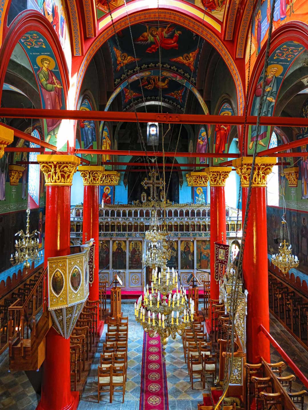


The characterization of the church contributes to the preservation of the special physiognomy of Pramanta, an interesting mountain settlement in the area of Tzoumerka (http://listedmonuments.culture.gr). In honor of Agia Paraskevi, which is celebrated on July 26, there is a traditional feast organised in Pramanta which lasts three even four-days.
It is located between Pramanta and Melissourgoi on a hill with splendid lush vegetation of spruce and fir trees. It is a walled large three-aisled basilica, covered stone slabs, with a loggia, cells on the front side, hostels on the first floor and a beautiful stone-made spring a little further. It was built in 1876 by the monk Dionysios Noutsos, as an engraved inscription says on the entrance.
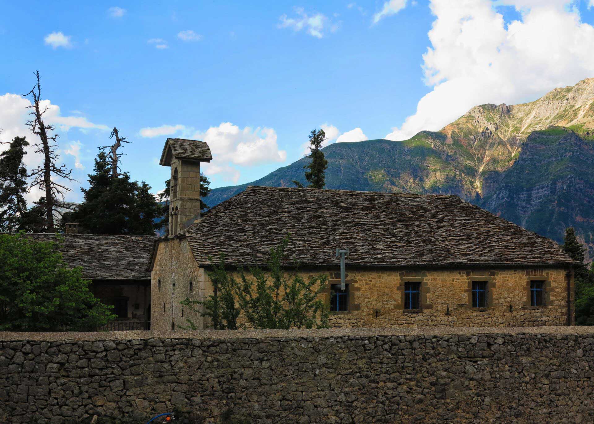


The monastery played an important role in modern history as it was the seat of the chieftain Putetsis during the 1912-1913 fights, and later used as a base by Napoleon Zerva’s teams. Inside, the remarkable icons in the iconostasis date back to 1839 and were transported here from the old church of Agia Paraskevi that was next to it. It celebrates on July 26th and becomes a religious function and a feast, but it is also open for the rest of the year because it is inhabited. Moreover, due to the beautiful natural location, the residents of the surrounding villages also prefer it for various social events (weddings, baptisms, etc).
Beautiful small church in Kato Mahalas. It was built in 1875-1876 at the expense of the Ptamantian Ioannis N. Rigas, of a well-known merchant with his trading center in Paramythia, from where he exported his products to Corfu and abroad.
It is located in the beautiful forest of Markopoulo.
The stone buidings of water
Tzoumerka is a predominantly mountainous and inaccessible area with amazing nature and rich water resources which people exploited with wisdom and moderation, subjugating nature and making it their ally.
This constant effort to survive in a bygone era is depicted in the bridges, watermills, mantania, fountains, wells, water saws, which are today stone monuments of the pre-industrial era. Some of the many and remarkable examples of traditional architecture are located in the area of Pramanta.
Historical monuments are an attraction, they recall important moments of history, but at the same time they serve as a pole of attraction for visitors. They are unique examples of the Εpirotic architectural tradition and modern Greek culture.

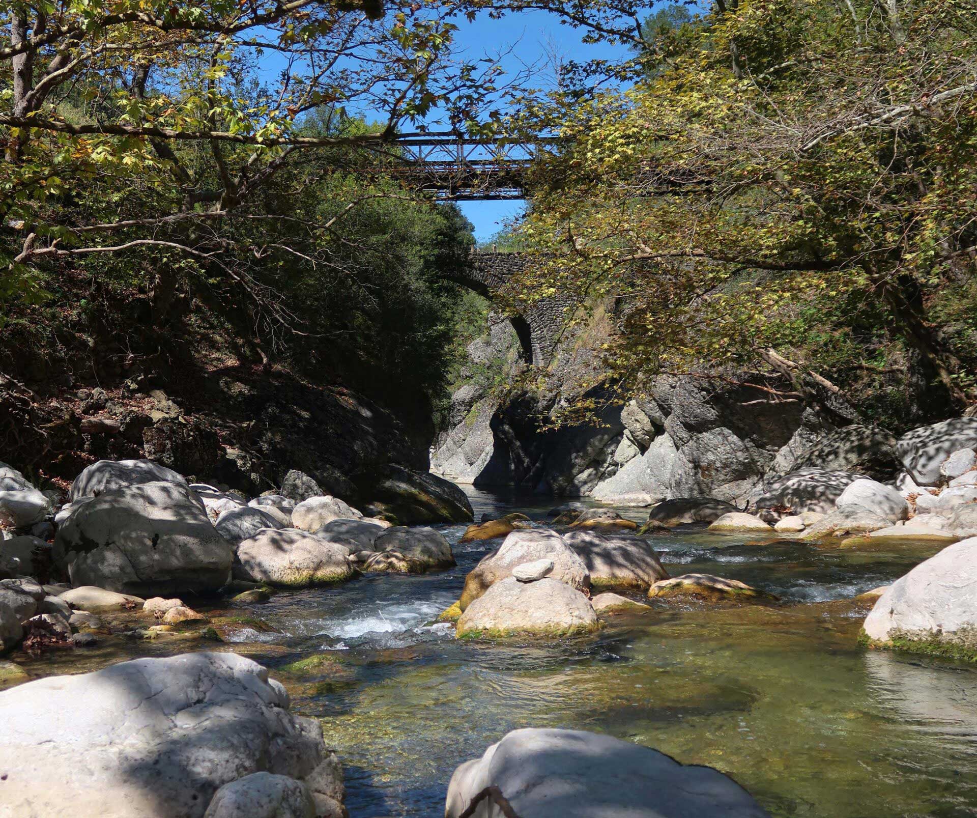
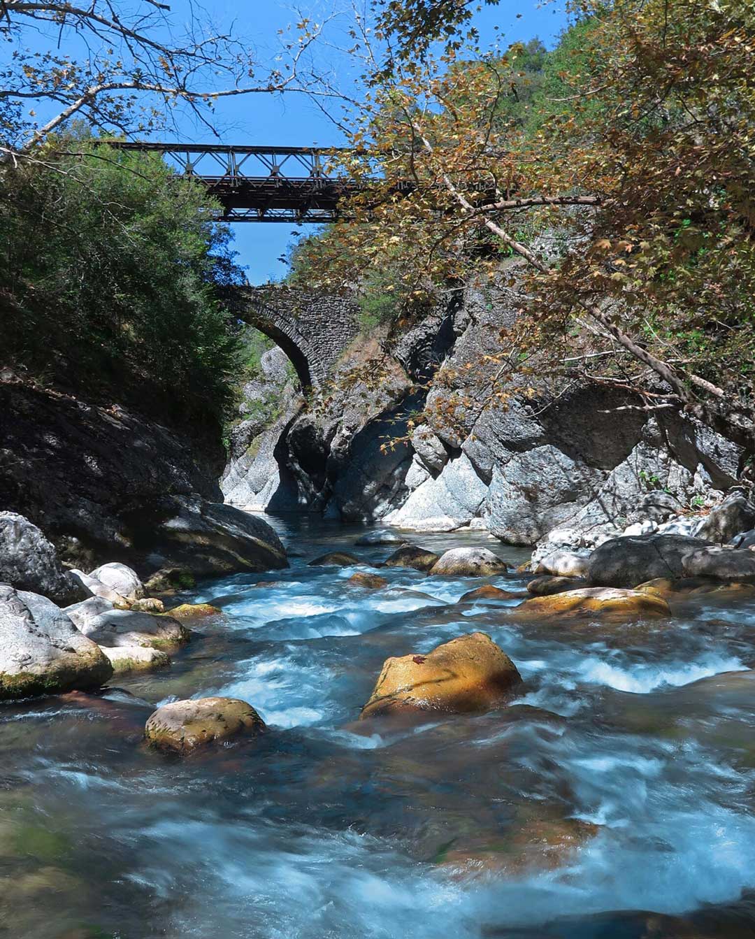
The bridge of Plaka is one of the most famous bridges, not only for its history but also for its perfect construction and its wonderful architecture. It bridges Arachthos, one of the most rapid rivers of Epirus and is the largest single-arched bridge in the Balkans and the third largest in Europe.
Historic monument, owned by the Tsaktsira brothers. It is a simple ground floor stone building of 1935. Remarkable are the cylindrical stone hoppers that carry water to the water mill and the impeller, but also the stone-built water mill, one of the few of its kind.
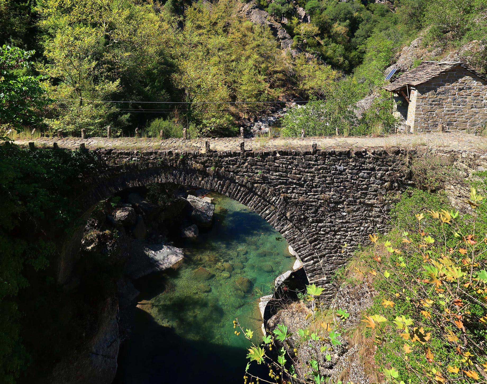
A two-arched bridge which bridges the Melissourgiotiko stream and is located immediately after the settlement of Christi on the way to Pramanta. It was constructed during the first years of liberation from the Ottomans (1833-1890) and replaced another older one located on the downstream.
Its condition is modest, as the deck has been coated with asphalt and the motorway passes. Next to it there is a traditional water mill, which in the period 1881-1912 was used as a military and customs outpost.


Next to the bridge of Christi there is a traditional watermill which from 1881 to 1912 was used as a military and customs outpost.
A single arched stone bridge with a flat deck that bridges Kalarrytiko River. It is perched on the cliffs of both sides of the river. The bridge was constructed by the merchant Sygounas fron Syyrako, as from this point he was passing his merchandise to Arta.


Before the construction of the bridge, the transport of the goods was carried out with a wire rope, which was fixed on both sides of the river. The bridge is located on the road from Kipina to Christi.


Activities
Gorges and waterfalls, peaks and rivers, mountain paths, forests and plateaus… majestic ornaments of the earth.
The area around Pramanta as well as the wider area of Tzoumerka is full of landscapes that seal the wild and authentic beauty of nature inviting the visitor to initiation and experiential enjoyment.
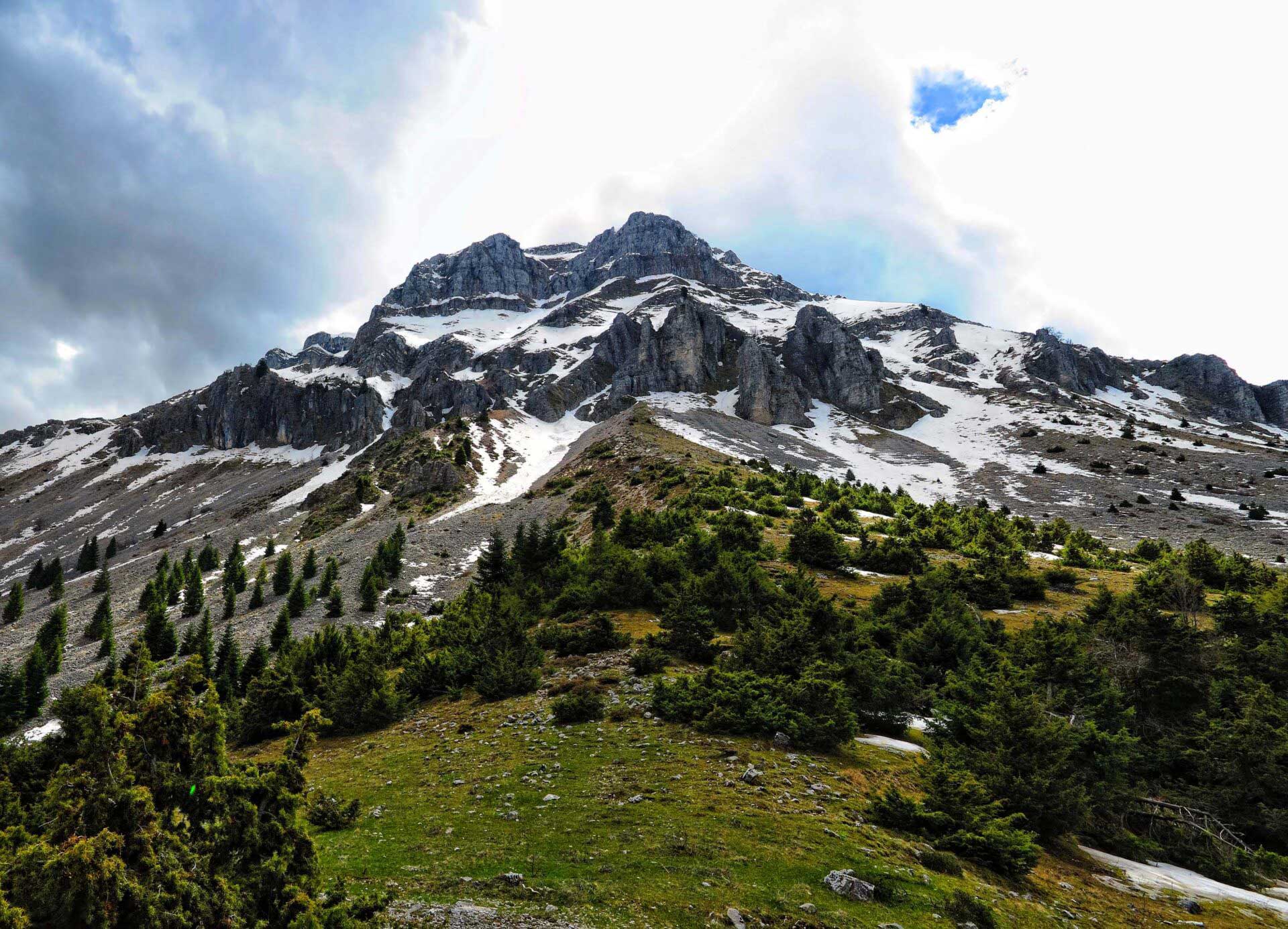
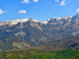
The beautiful peak of Tzoumerka with its characteristic shape is the trademark of Pramanta and a favorite peak of climbers.
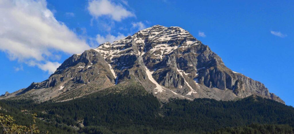
Impressive in all seasons and visible from all sides, it magnetizes the eye.

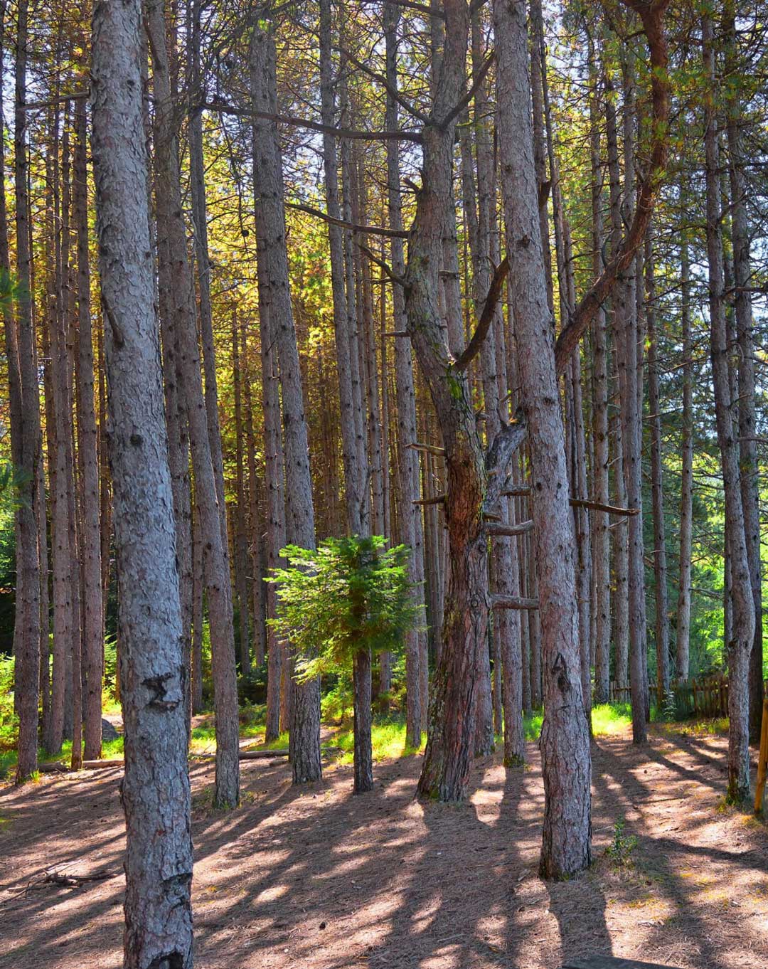
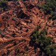
The fir forest above the village.At a time when the population of the village had increased and the arable land was not enough, they cleared various parts for cultivation. When the cultivation stopped, the forest was reforested and reached its current form.
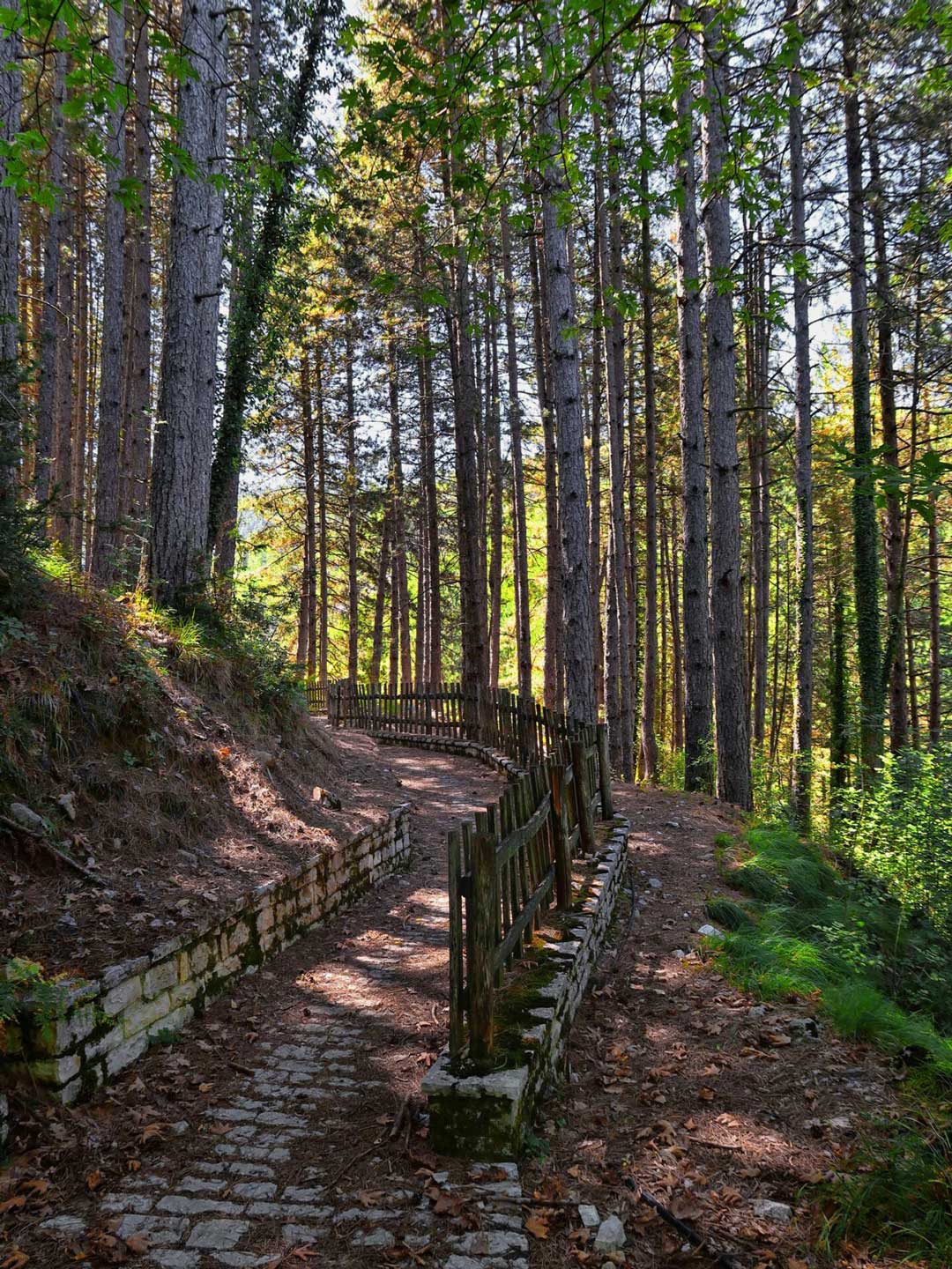


From the village starts a path and a wonderful route in the fir forest. First stop is the Skala spring which is the source from which the village is supplied with water. It is called Skala (staircase) because it is the first step for the ascent to the forest of Markopoulos. The next source is Kerasia and the path reaches the Pramanta refuge.
It is built at an altitude of 1260 m. On a beautiful plateau below the north side of Stroggoula and with stunning views of the volume of Kakarditsa.


It has been operating since 2006 and has beds, organized kitchen, dining area, living room and fireplace. Next to the refuge, a small open-air theater is built.
A settlement of Pramanta which in recent years has been significantly exploited. It is a summer destination of many Pramantiotes who live far away and come to their homeland in summers. The square of the settlement is very beautiful and in general it is a very well-kept settlement.
A few kilometers from Pramanta is the village Melissourgoi with the three squares and the volume of mountains around with the wild beauty that fascinates. In the center of the village is the first paved square with fountains and plane trees, a little above a second paved square and at the bottom of the village is the square of Panagia. From the beautiful villages of Tzoumerka with impressive areas for exploration and activities and with tourist infrastructure.
Also, a short distance above the village is the refuge of Melissourgoi at an altitude of 1209m. It is open all year round and consists of 5 rooms, chalet and kitchen. The rooms have five beds, heating and a private bathroom. The kitchen is open daily from early in the morning until late at night, offering a full board for guests.
Strogoula never ceases to fascinate. From the north side, the cascade of Kefalovrysso springs with a length of 350m. and with a constant flow of all seasons. The waterfall in its course forms the stream of Koferita which flows into the stream of Melissourgoi.

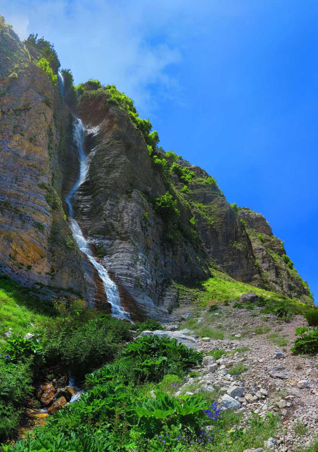
The route is easy and marked and starts either from the Pramanta Refuge or from the Melissourgoi Refuge. We walk in a fir forest for about half an hour until we we go out in an open area. Following the course and having visual contact with the waterfall we walk for about forty minutes. Leaving the gaze to wander from right to left we see the northern part of Strongoula, Gerakovouni and the peak Agathi, the Neck of the Ear and finally the impressive mountain range of Kakarditsa.
Three kilometers from Pramanta is the cave of Anemotrypa and is something you must see.The cave was discovered in 1960 and explored by Anna Petrocheilou. A part of the cave about 270 meters long was studied and explored. In 2000 the 250 meters were used for tourism and today it is accessible to visitors.
The cave has three levels. The tallest and oldest collapsed in the past and some parts of it are preserved. The middle level is what has been used for tourism. The third level is the underground riverbed, which is seen at the end of the tourist path,just before creating a waterfall 2 meters, 10 meters lower than the path.

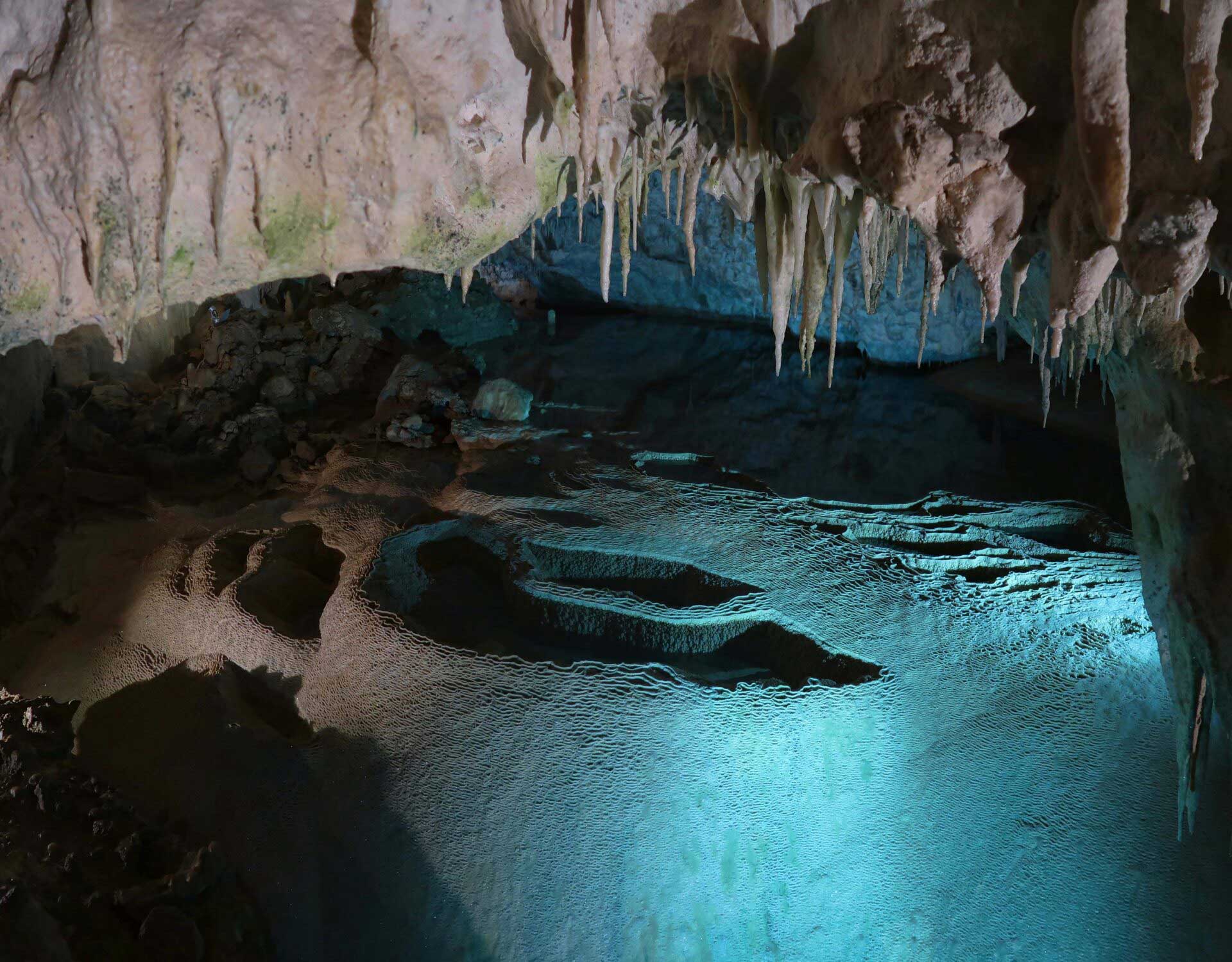
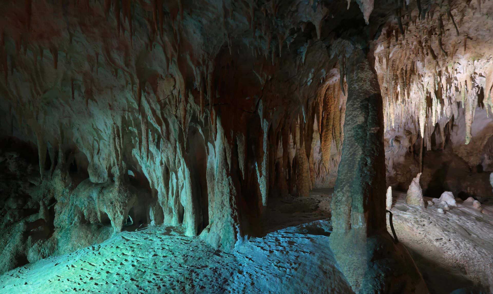
The water of the river appears again in a spring located in the ravine, 25 meters below the entrance of the cave. Stalactites and stalagmites with various formations and colors create an eerie backdrop. And of course what the visitor perceives is the clean atmosphere that shows that the cave has natural ventilation, and also is felt the complete lack of smell from the mold that most caves have.
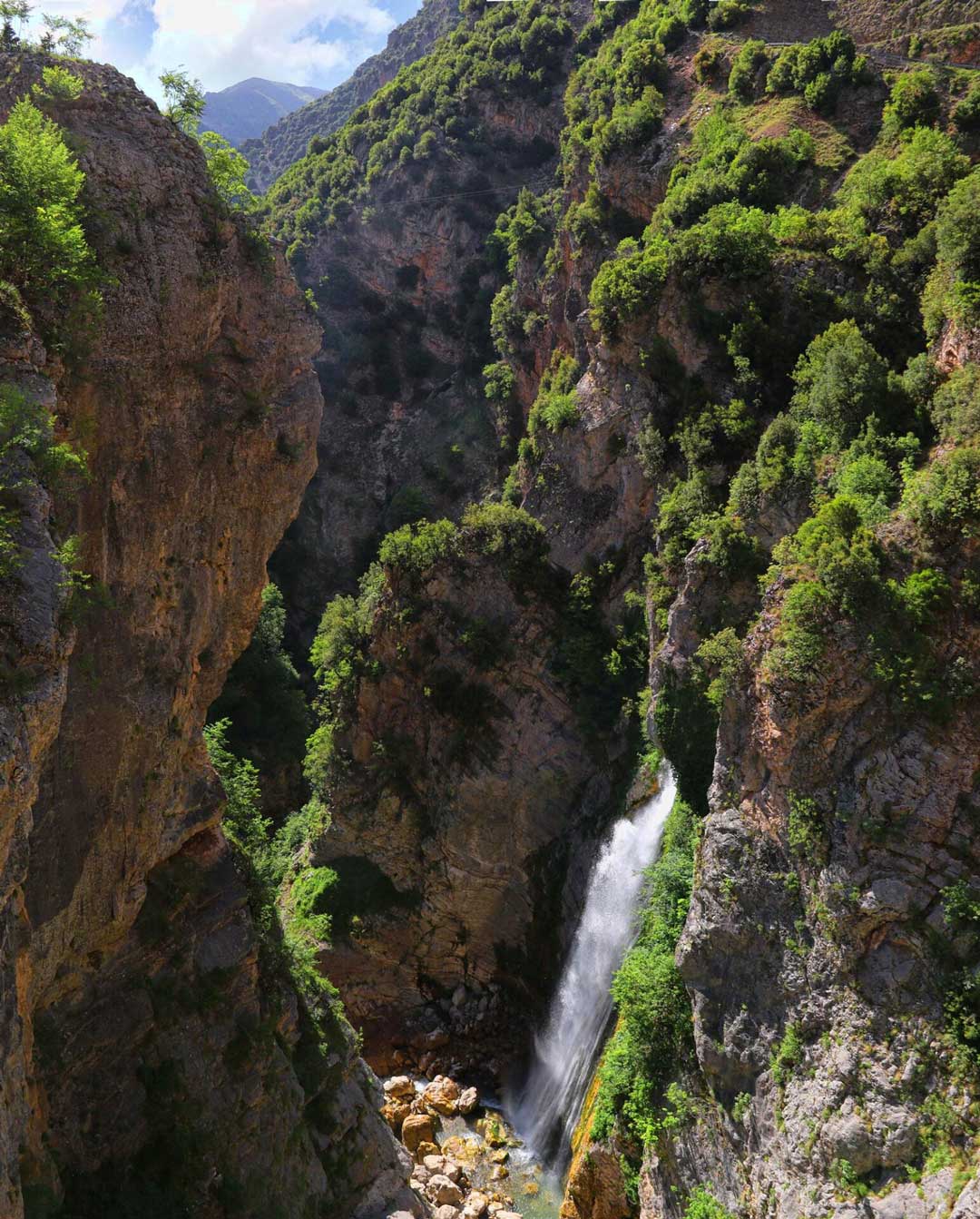
The waterfalls are located near the settlement of Kriopigi which belongs to the village of Katarraktis on the western slopes of Tzoumerka. The northern waterfall is more rapid and has a height of 87 m., While the southern reaches 100 m. Above them stand the northwestern peaks of Tzoumerka, thus creating an impressive setting.
The water from the mountain ends after a serpentine course of about 10 kilometers in the river Arachthos. In the area of the waterfalls, a paved path and bridges have been created, so the approach is very easy, while a refreshment room is very close. The best time to visit them is towards the end of May, as then the waters are many and the force of their fall is impressive.
One of the most impressive waterfalls in the area is located just before the village of Matsouki. This is the “Kamili” waterfall which is impressive not for its height (50 meters) but for the large volume of water that descends even in the summer months. Streams are created from the high peaks, such as Katarrachias (2280m.) And Kritharia (2200m.).

Two of them, Mavrias and Goura, cross Matsouki and creating an impressive waterfall they pour from a height of 50 meters. A little further on, they join the Red River and together they flow into the Matsoukiotiko Stream, which crosses the homonymous gorge, and in the process receives the waters of Karlibou stream.

Important information – Sources
Much of the historical information you will find in the article was based on the book “Πράμαντα Τζουμέρκων – Ιωαννίνων, Ιστορία – Λαογραφία” by the Pramanta Brotherhood.


This is a great resource and you should be commended on doing such a beautiful job.
Thank you so much for your kind words!
I agree with Niko! Bravo kai yeia sta xeria sas!!!
Thank you so much!